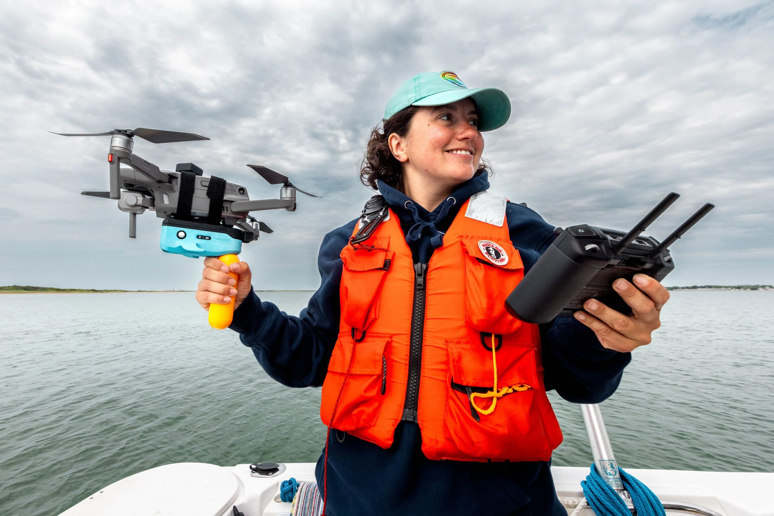
A LiDAR rangefinding altimeter that attaches to consumer drones, best suited to the DJI Mavic series and drones of a similar size or larger. It records the drone's true height above the target once per second, which is the missing variable needed to turn aerial imagery into accurate measurements of marine megafauna.
With a precise altitude reading, photogrammetry from a single overflight yields reliable length, girth, and body-condition data without tagging, capture, or contact. It works across species, from blue whales and humpbacks to whale sharks and orca, and deploys from a boat or the shore.
An optional handle supports hand launches and recoveries from boats, where deck space is limited and a stable takeoff or landing point isn't available. Hand launches require safety gear - e.g. goggles, helmet, and hand protection.
WHASER saves a CSV datalog file onto its internal storage containing GPS time, orientation, LiDAR altitude, and other data. This can be compared with the drone’s photographs to ascertain the exact altitude at the time the photo was taken, allowing the animal to be measured and assessed. The researchers we work with usually import this data into the MorphoMetrix software developed by Oregon State University.
Details:
Drone agnostic (suited to DJI Mavic & ANZU)
‘All systems go!’ OLED display
Optional grip for hand-launching
USB-C charging
USB-C data access
LiDAR sensor: Lightware SF20/C
6 hour battery life (in 25°C conditions)
Weather resistant
1 Hz sample rate
WHASER weight: 170g
WHASER + Recovery Handle weight: 215g
Total weight in hardcase: 2200g
WHASER Dimensions: 148×229×61 mm
Hardcase dimensions: 321×229×111 mm
Included:
1 x WHASER (including velcro strap mounting plate)
1 x Yellow recovery handle
2 x Velcro mounting strips
1 x Hardcase (Nanuk 909 with custom inner)
A LiDAR rangefinding altimeter that attaches to consumer drones, best suited to the DJI Mavic series and drones of a similar size or larger. It records the drone's true height above the target once per second, which is the missing variable needed to turn aerial imagery into accurate measurements of marine megafauna.
With a precise altitude reading, photogrammetry from a single overflight yields reliable length, girth, and body-condition data without tagging, capture, or contact. It works across species, from blue whales and humpbacks to whale sharks and orca, and deploys from a boat or the shore.
An optional handle supports hand launches and recoveries from boats, where deck space is limited and a stable takeoff or landing point isn't available. Hand launches require safety gear - e.g. goggles, helmet, and hand protection.
WHASER saves a CSV datalog file onto its internal storage containing GPS time, orientation, LiDAR altitude, and other data. This can be compared with the drone’s photographs to ascertain the exact altitude at the time the photo was taken, allowing the animal to be measured and assessed. The researchers we work with usually import this data into the MorphoMetrix software developed by Oregon State University.
Details:
Drone agnostic (suited to DJI Mavic & ANZU)
‘All systems go!’ OLED display
Optional grip for hand-launching
USB-C charging
USB-C data access
LiDAR sensor: Lightware SF20/C
6 hour battery life (in 25°C conditions)
Weather resistant
1 Hz sample rate
WHASER weight: 170g
WHASER + Recovery Handle weight: 215g
Total weight in hardcase: 2200g
WHASER Dimensions: 148×229×61 mm
Hardcase dimensions: 321×229×111 mm
Included:
1 x WHASER (including velcro strap mounting plate)
1 x Yellow recovery handle
2 x Velcro mounting strips
1 x Hardcase (Nanuk 909 with custom inner)

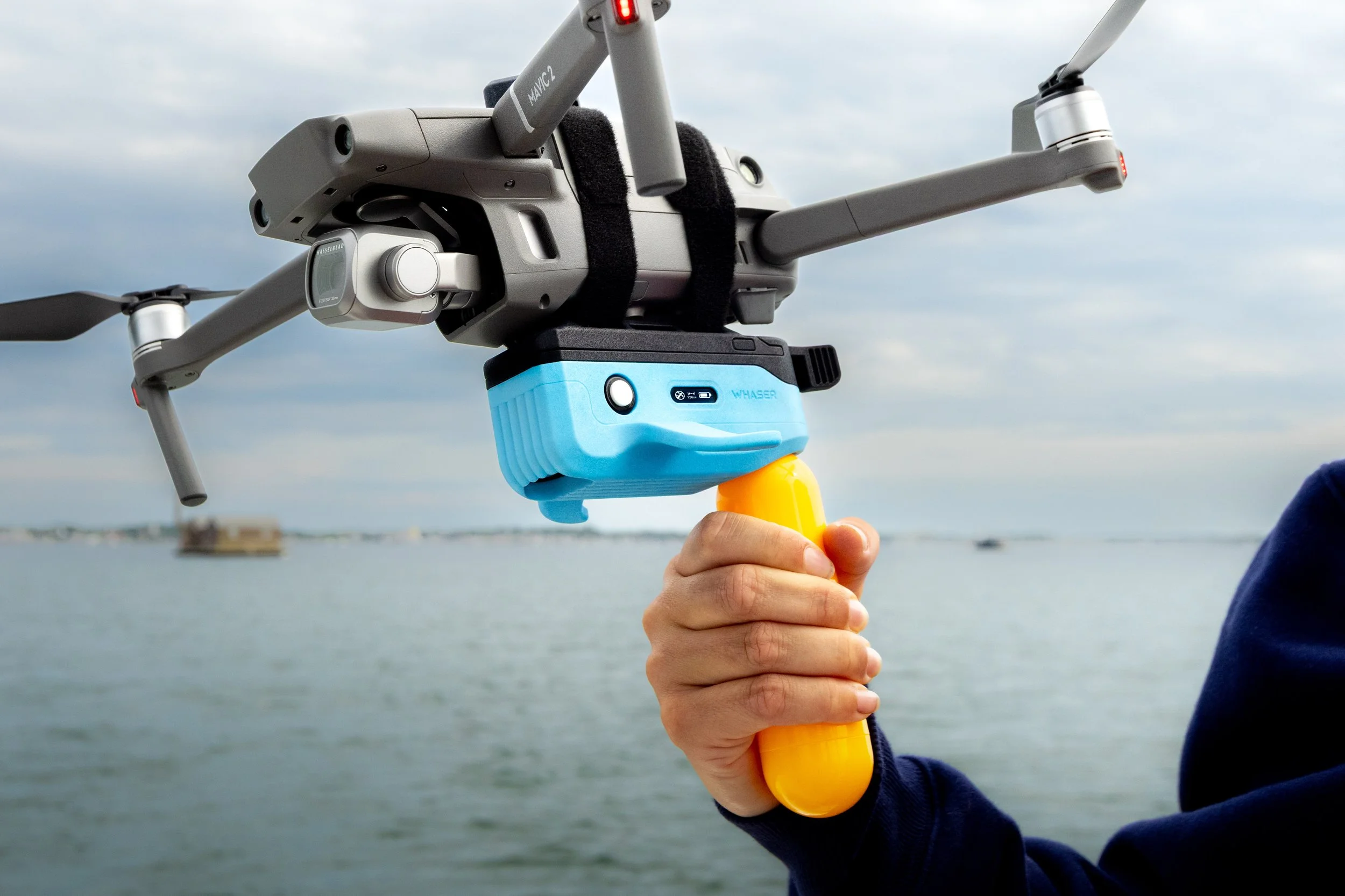 Image 1 of 8
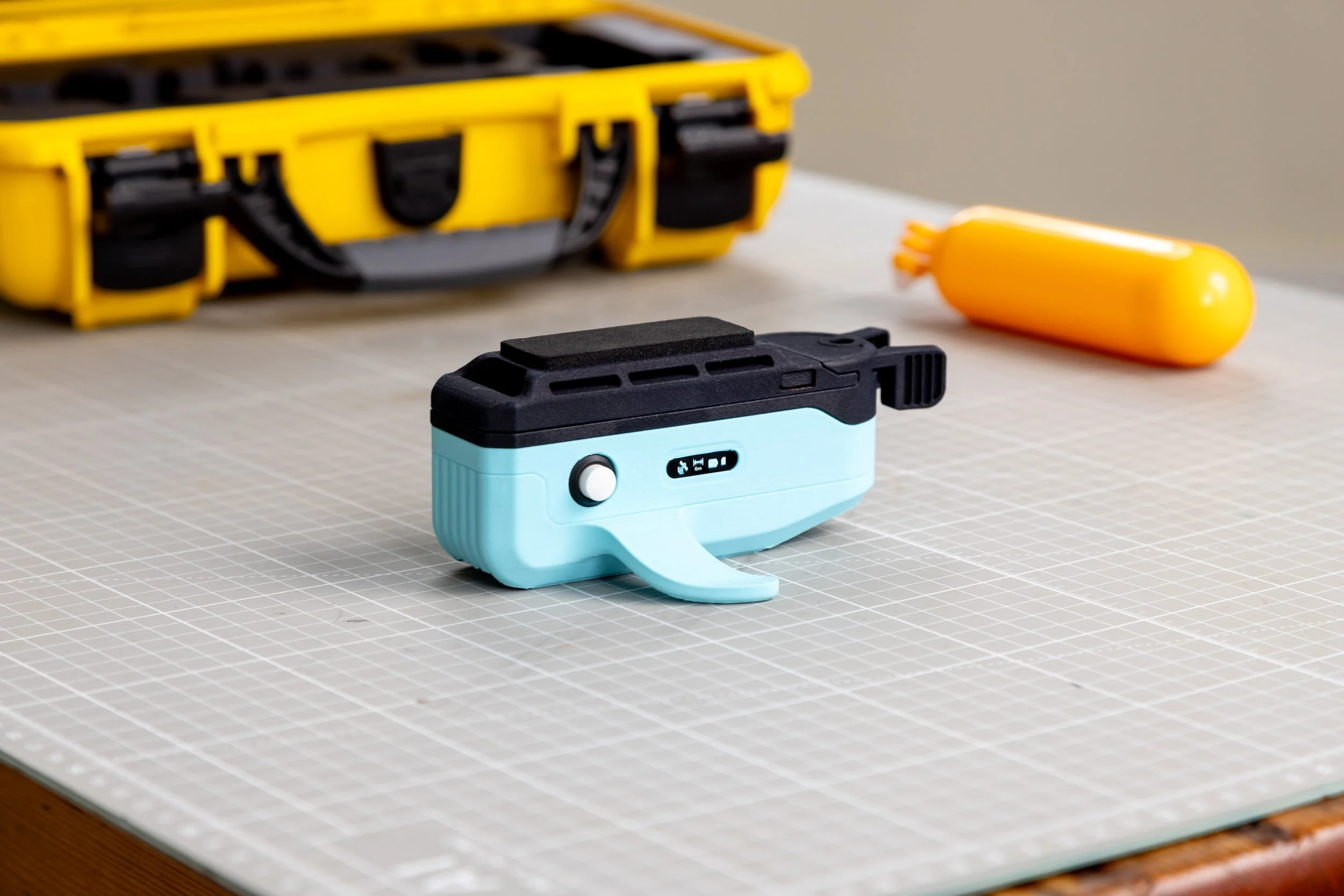 Image 2 of 8
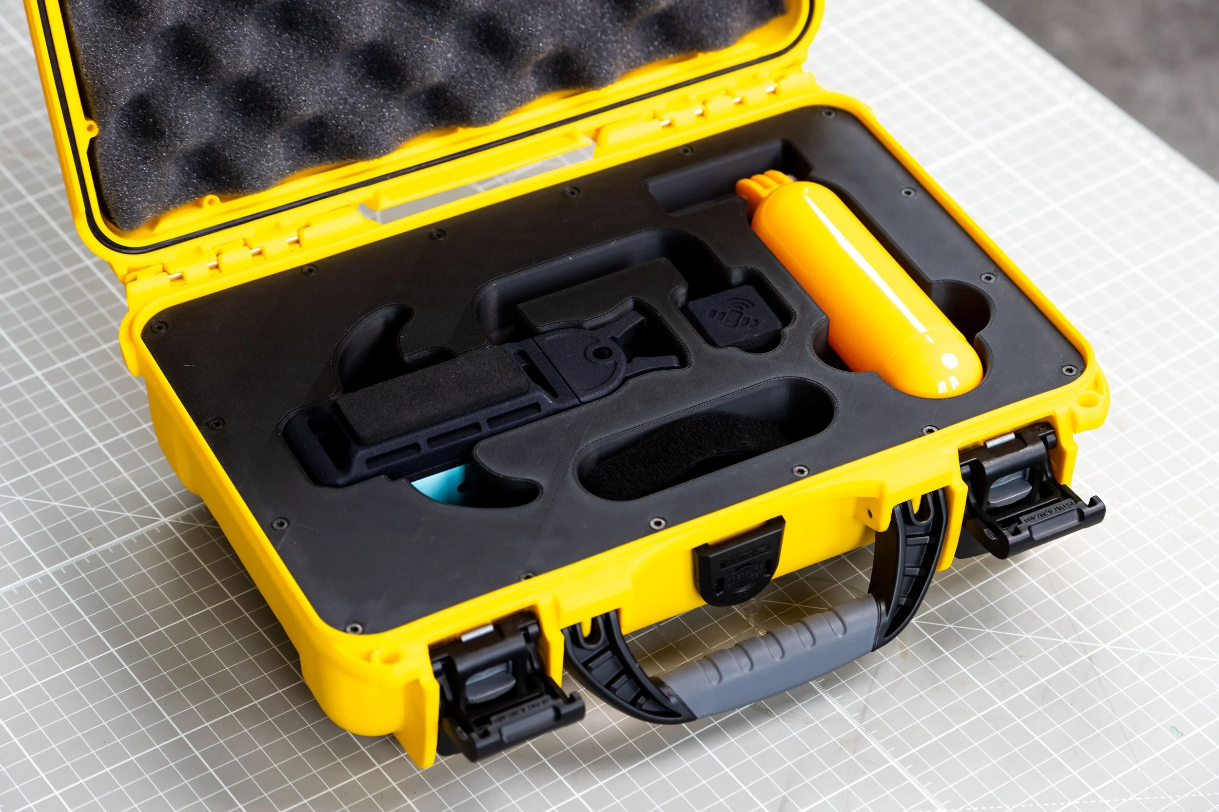 Image 3 of 8
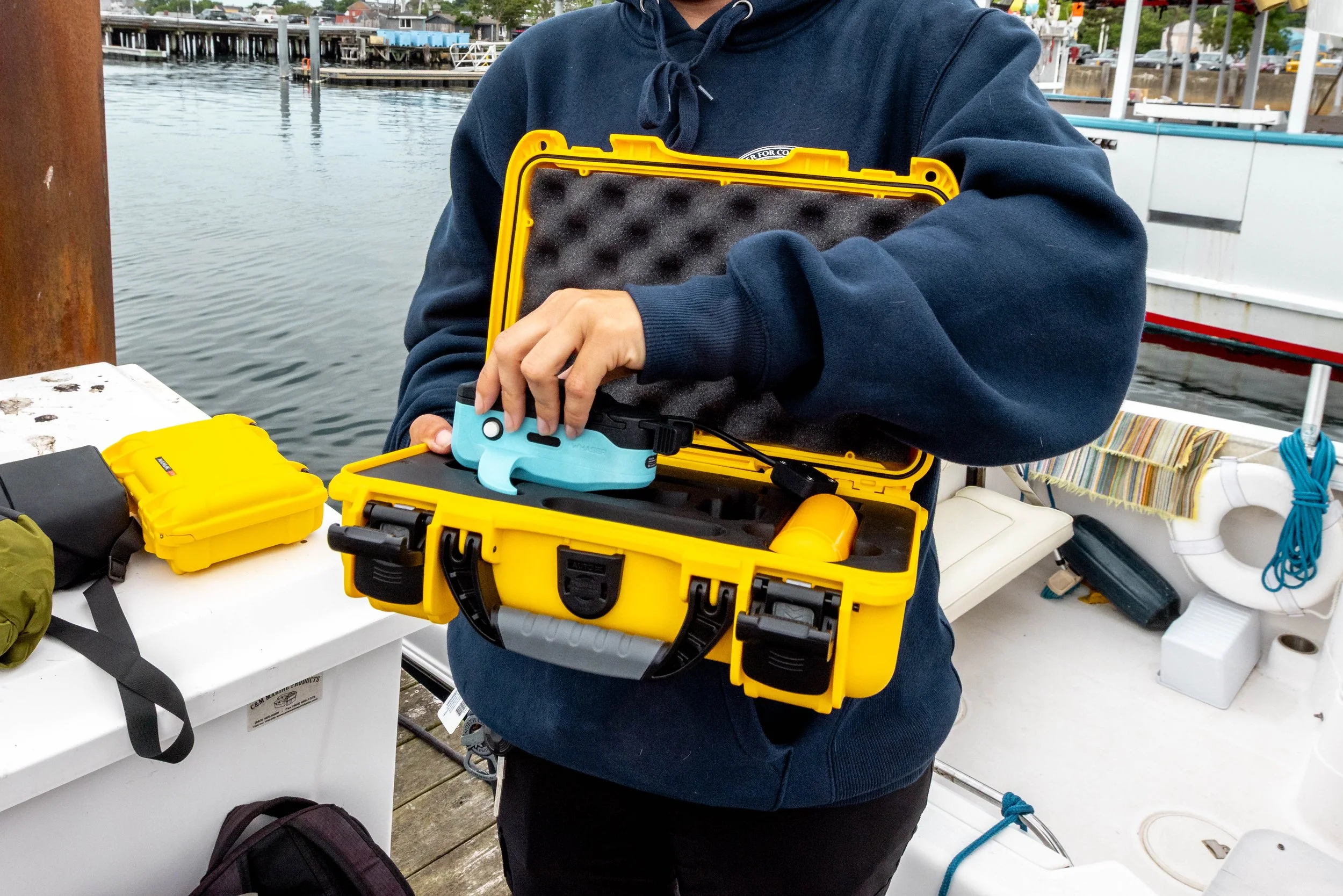 Image 4 of 8
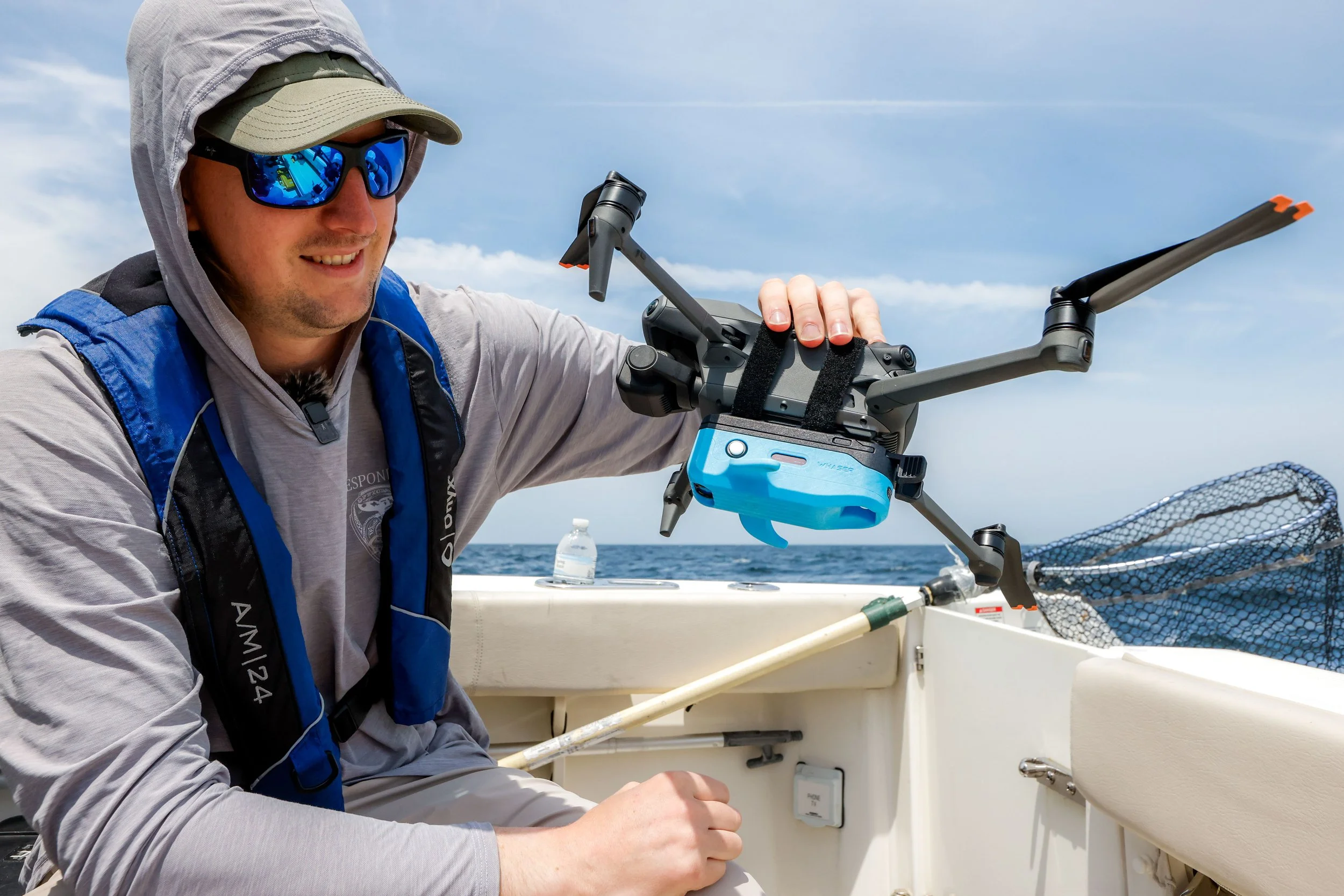 Image 5 of 8
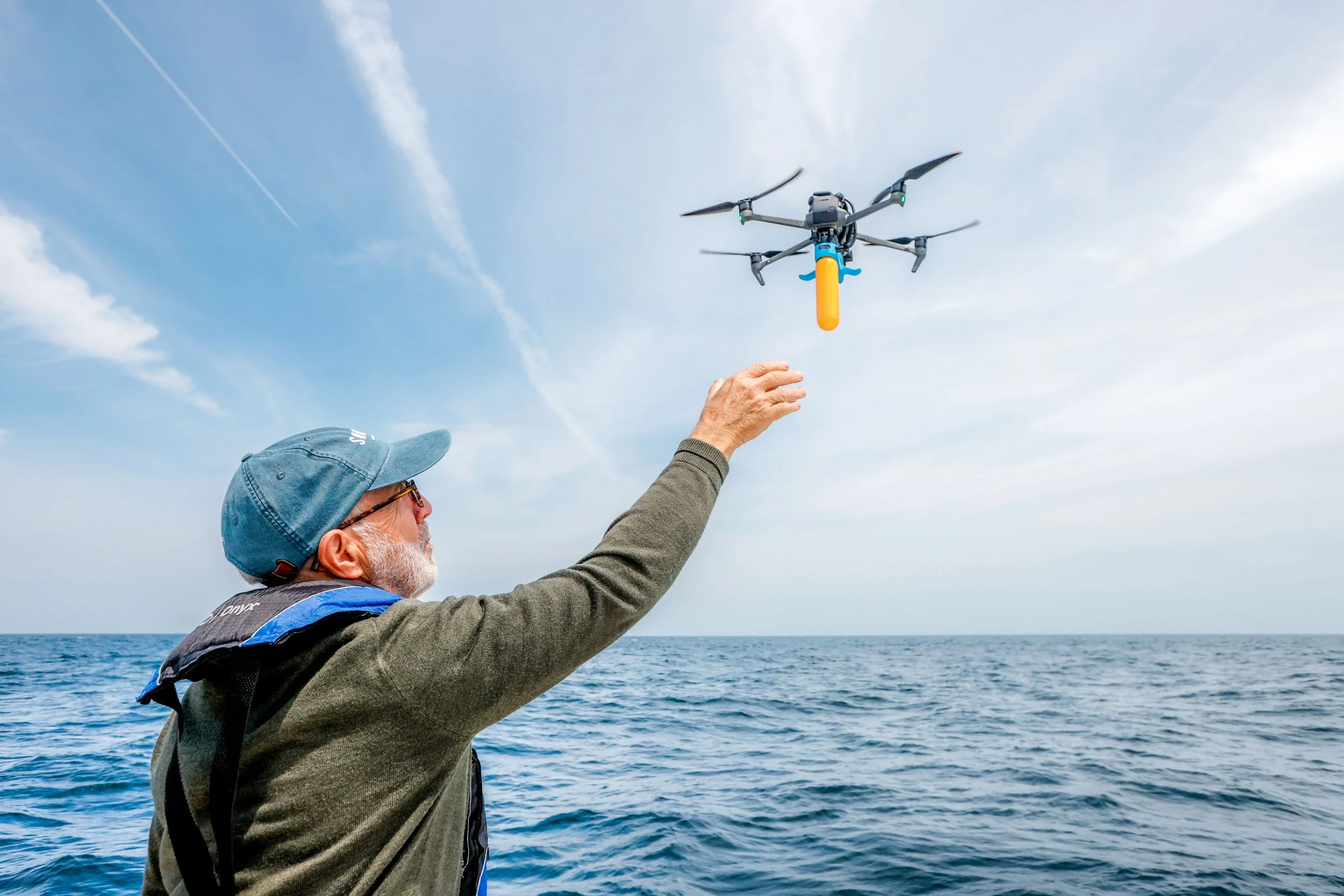 Image 6 of 8
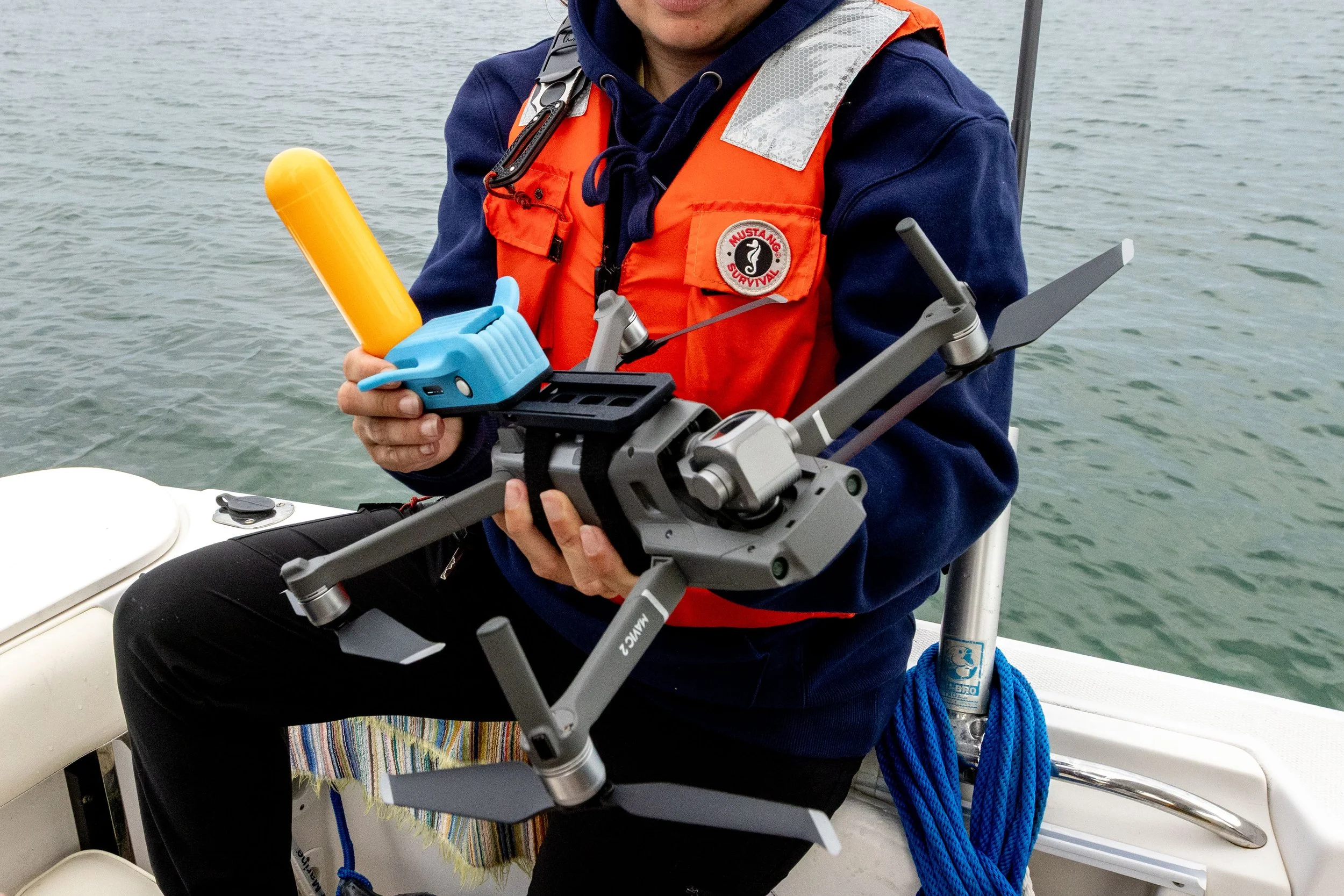 Image 7 of 8
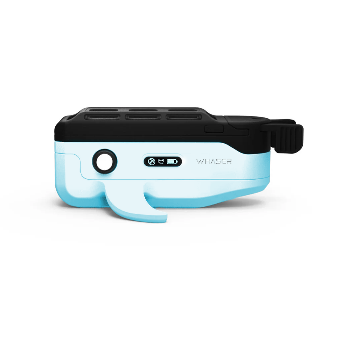 Image 8 of 8