

WHASER
A better tool to measure large animals.
Designed and built by Tandem Ventures, in collaboration with the charity Whale Wise.
Enabled by our wonderful partners:

Interested in purchasing a WHASER?
Watch the film
Watch as we meet the heroes of whale conservation, and innovate towards a better tool to help them on their mission.
The product.

WHASER is a range-finding tool that attaches to drones to provide accurate altitude data. By combining this with the drone’s images, objects (or whales) in view can be measured.

Key features
Safe, easy to use design
‘All systems go!’ display
Optional grip for hand-launches
Drone agnostic (suited to DJI Mavic & ANZU)
Weatherproof
USB-C charging & data access
6 hour battery
LiDAR sensor: Lightware SF20/C
Weight: 170g
WHASER is small and lightweight, to maximise the flight time of the drone.
Thin walls, compact electronics arrangement, and removing unnecessary material all help optimise the design.


Optimised performance.
WHASER is optimised for distances of 0.2 to 100m, ideal for drone applications.
Refined geometry keeps sensitive lenses away from debris.
Built from the ground up.
A custom PCB houses all of the components in a compact manner, keeping the weight and amount of wiring to a minimum. The system is programmed into an ESP32 Nano microcontroller.

WHASER,
The story of
how the product was born.
Fishing gear entanglement is a major threat to whales.
Lines and nets can entrap whales, restricting movement and preventing essential activities like feeding. This often leads to death by drowning or starvation.
Survivors endure prolonged suffering, sometimes remaining entangled for years, with scars serving as stark reminders of their ordeal.

We met with Jess Ward from the charity Whale Wise.

Jess told us how they’d been assessing the long term impacts of entanglement on humpback whales in Iceland.

A key part of the research involves measuring the whales to assess their health.
This is done by attaching a LiDAR range-finding unit to a drone, and flying it over the whales.
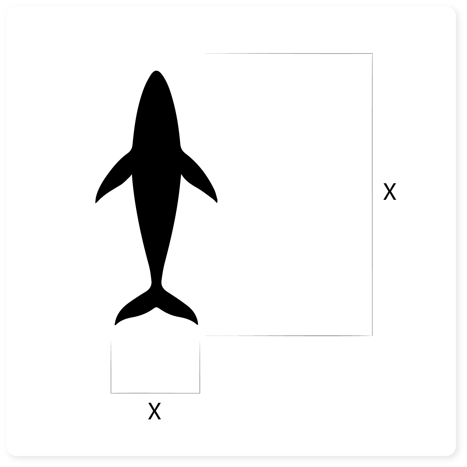

By combining this data with the drone’s photos, the whale can be measured.
The LiDAR unit accurately determines the drone’s height above a whale.
We spent a day with Jess to see their current equipment in action.
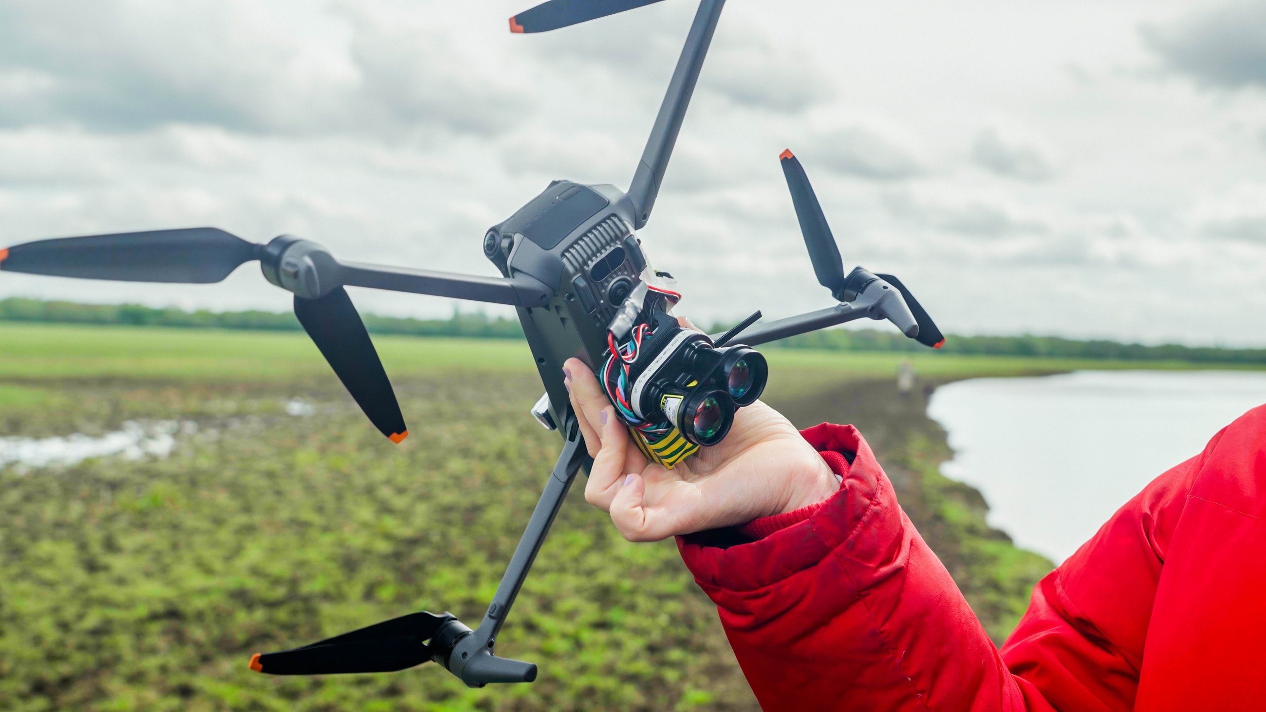

We sent out Sam on a paddleboard to simulate a whale, and Jess flew the drone and LiDAR unit over him.

By combining the LiDAR data with the drone’s photos, Jess was able to measure the whale (or in this case, the humpback Rogers).

However, the equipment had many problems.
Loose wiring, susceptible to damage from the drone’s propellors,
Inaccessible SD card,
Lack of feedback (GPS, data-writing, battery level, etc.),
Difficulty landing or catching the system, due to the fragility of the LiDAR.
We decided to design a new LiDAR system for Whale Wise and other research organisations worldwide.
We built and tested various physical prototypes, exploring approaches for an easy-to-use tool.


We combined the merits of each concept with the new electronics into a fully functional prototype, and headed to the north of Iceland to put it to the test.
After finding Jess and the rest of Whale Wise, we revealed the prototype.


Key aspects of the prototype
Detachable, secure handle.
Landing legs (disguised as fins), allowing the device to be landed on the ground.
Recessed LiDAR to protect it during landings.
OLED screen with an ‘All systems go!’ check, with information on the GPS status, battery level, SD card, and a live readout from the LiDAR.
Locking mechanism to attach it to the drone, even while wearing gloves.
USB-C charging, with an integrated battery.
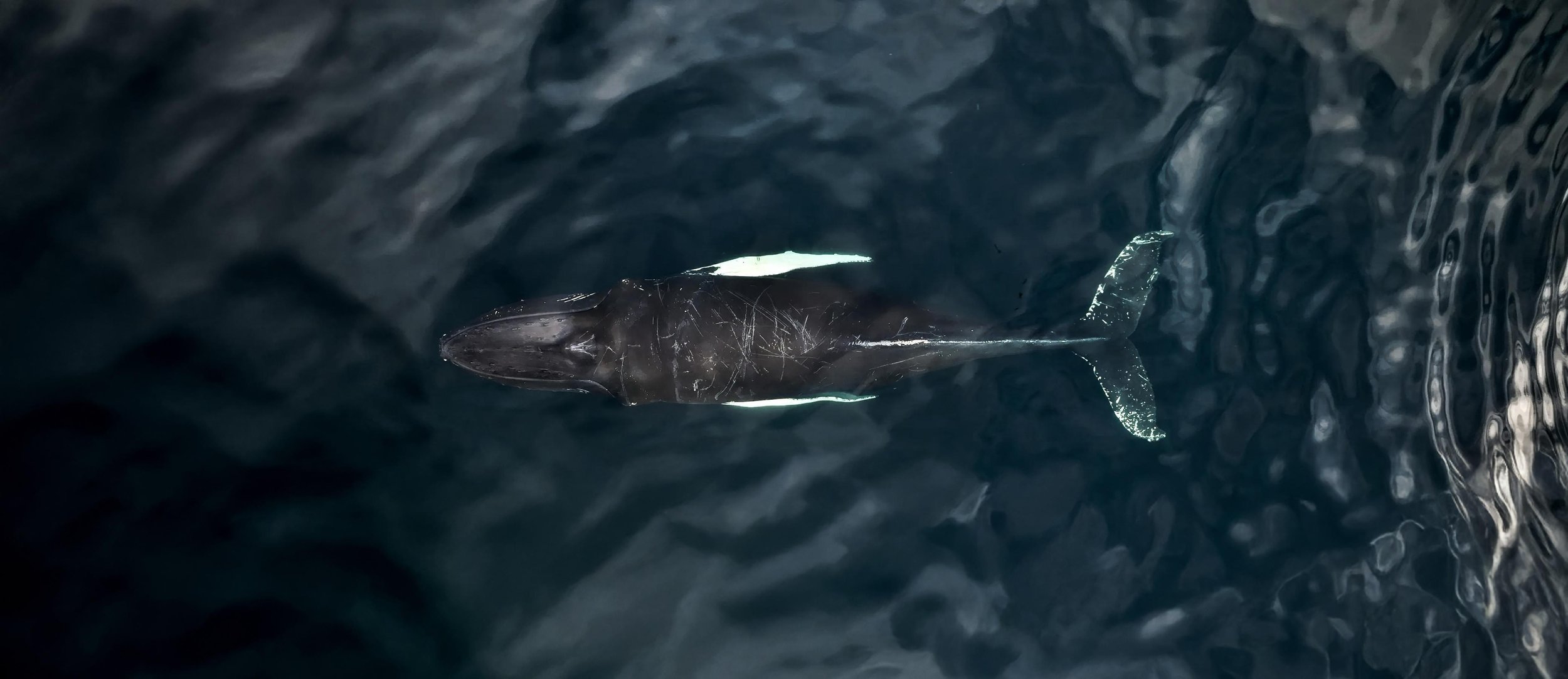
We flew the prototype over a humpback whale.
The data was verified at Whale Wise’s coastal base - the whale was a known individual to the charity, corroborating our new data.


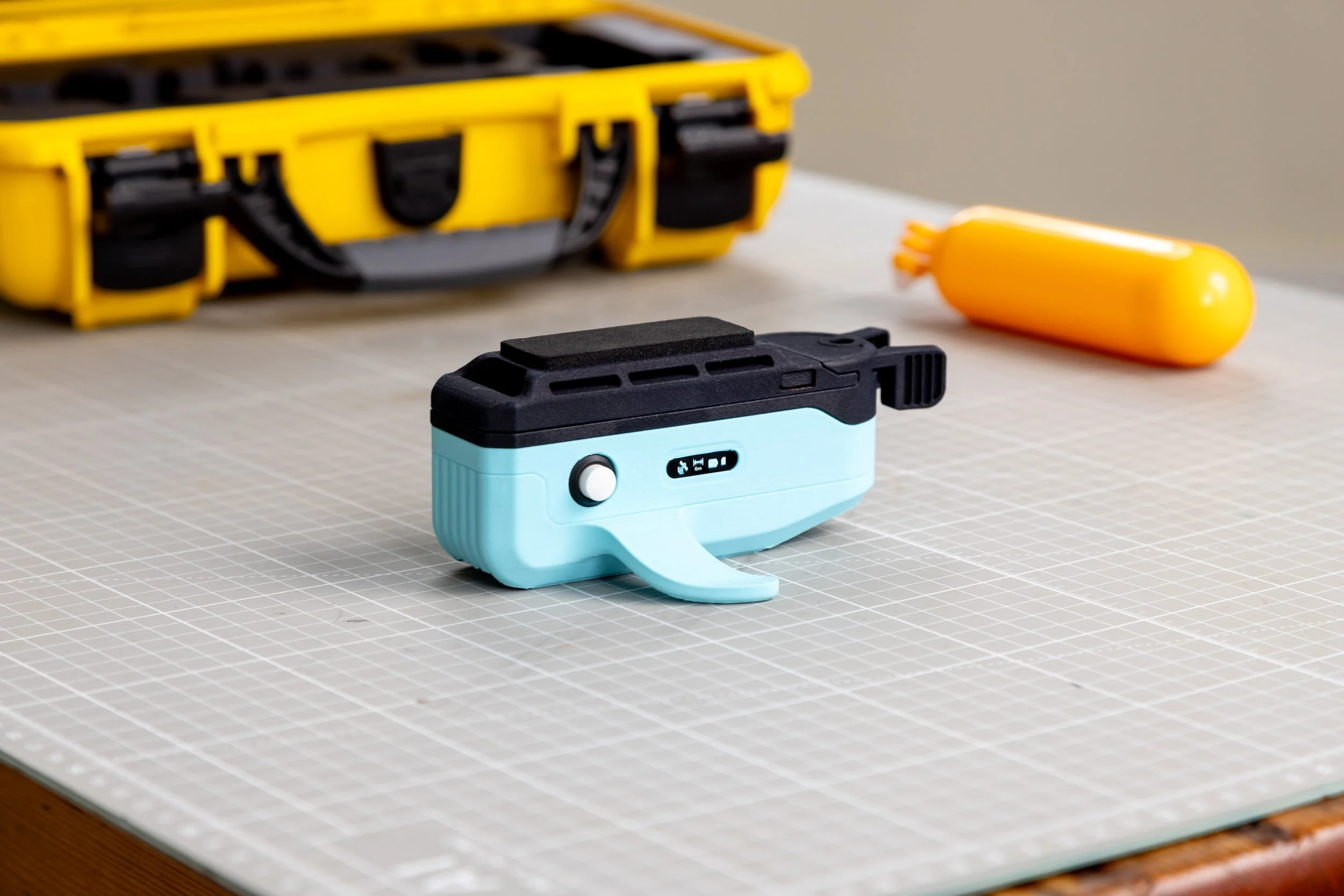
With the final learnings from the Icelandic deployment, we refined the concept into a final, fully productised design.

The final product is even smaller and lighter than the prototype.
For more information,
get in touch.
